Just how well can you describe what you are looking at to someone else? Telling a story about the landscape is at the heart of battlefield guiding. But how sure can guides be that this audience has understood exactly what they are talking about? Just because the audience nods sagely when the guide asks if everyone understands doesn’t mean they all do. But, unless the members of the audience all know what the guide is talking about, they will go home with an inaccurate picture.
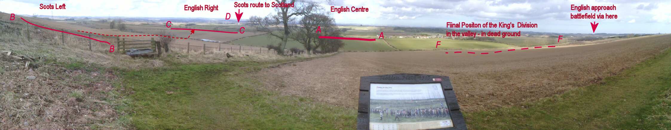
On a recent Introduction to Battlefield Guiding course we conducted an experiment to see how easy, or difficult it is for guides to identify exactly what points on the ground they are talking about. A panorama of the battlefield of Flodden was projected onto a screen. Students were asked to point out some of the locations to an audience relevant to telling the story of the Battle of Flodden. Each student was given a sheet of paper with a copy of the panorama and asked to mark on the panorama where they thought the locations being described were. The results are shown in the illustration 1.
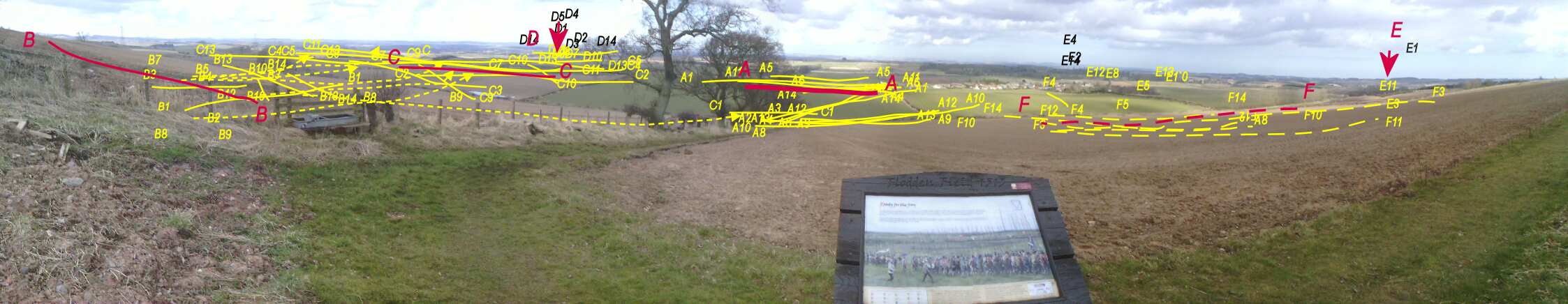
The overall results are shown in Illustration 1. The students describing the locations lettered A-F were given a sheet with one of the pink lines. The yellow,and black letters A-F show where other students positioned these points. This is a bit crowded, but as you can see, there is quite a bit of variation in almost each location. Some locations are easier to describe than others. We should not be too critical of our experimental subjects. The task might have been easier if the audience members had a map in front of them. However, not everyone can read a map and relate it to the ground.
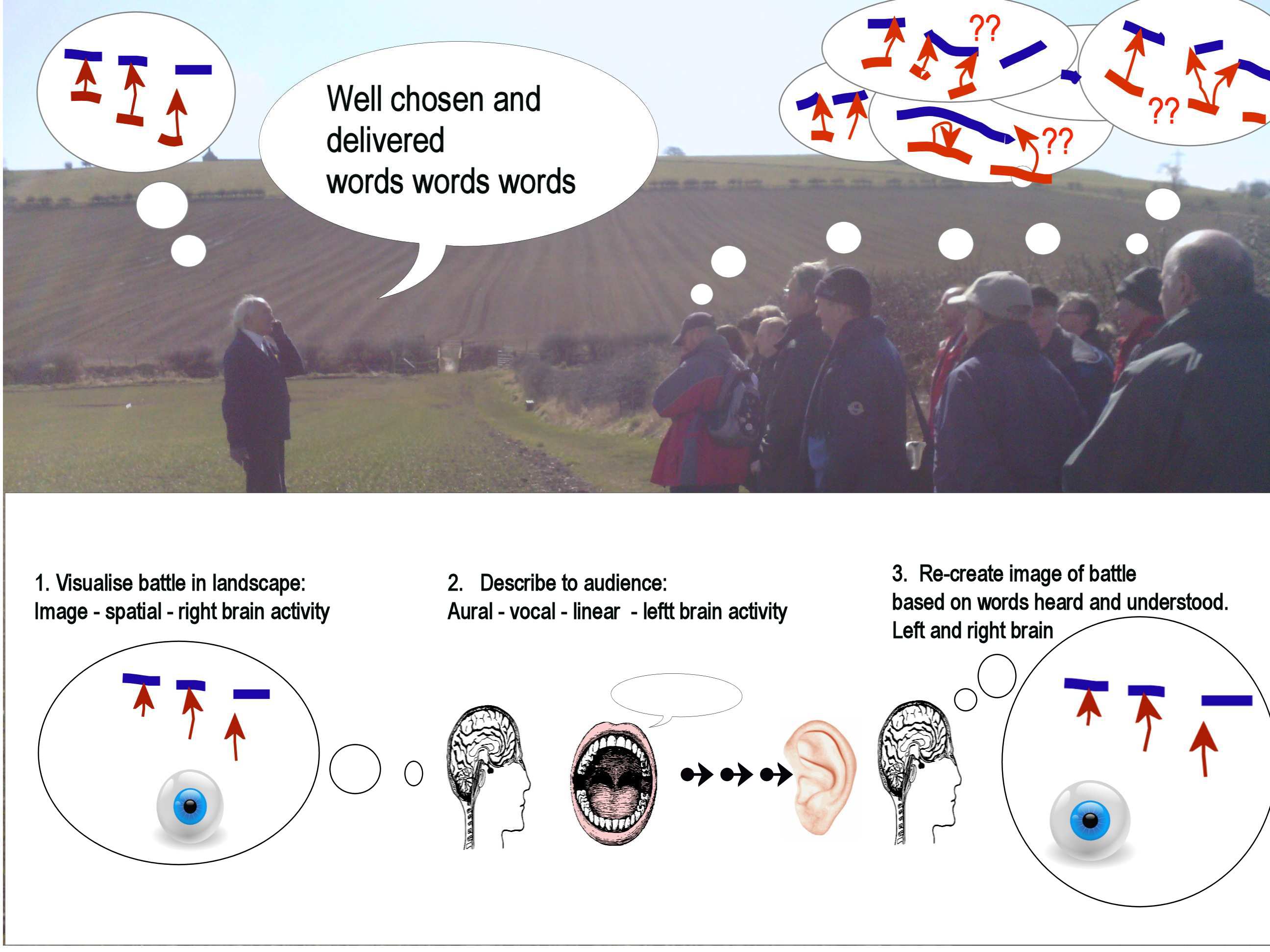
Although the task of indicating positions on the ground is a common and obvious task for a guide, it asks a lot of the collective brains of the guide and audience. We are asking someone to look at a visual image and describe it in words which the audience then uses to construct their own image. (See Illustration 2.) If we want to understand what some artist such as Constable saw it is far easier to look at the Hay Wain than to visualize the work from a description. Visual and verbal communication are processed in different ways, and even by different parts of the brain. Words may have a different meanings for audiences with a range of linguistic skills and vocabularies.
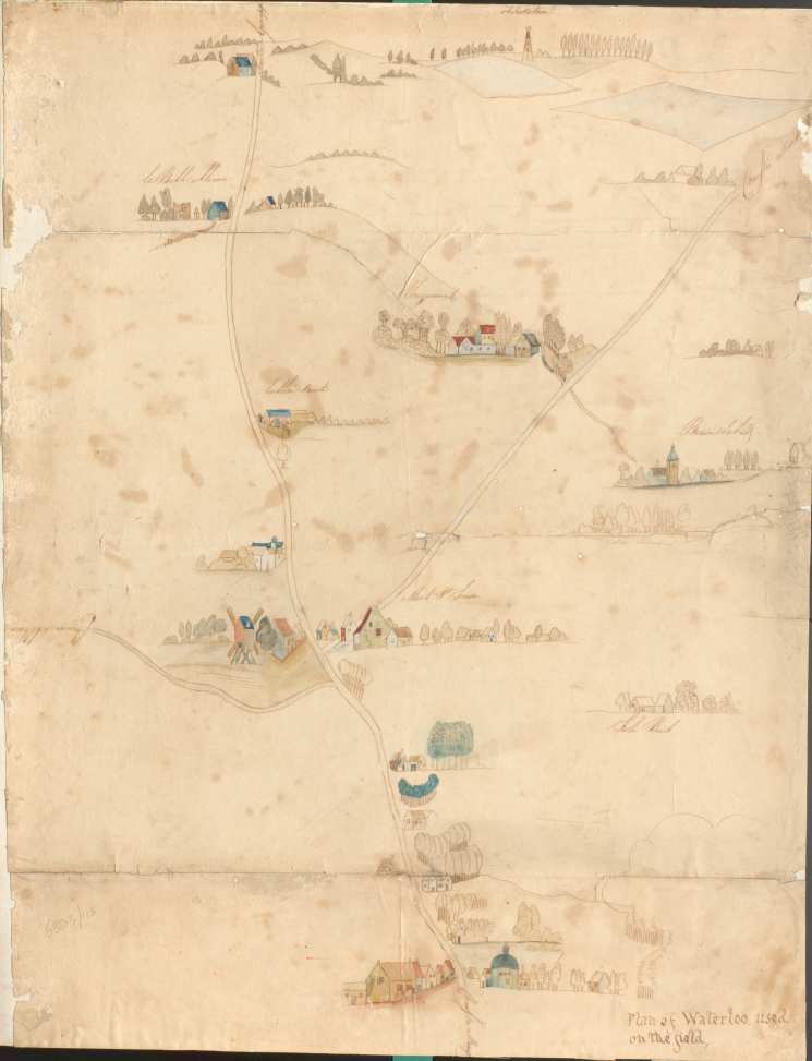
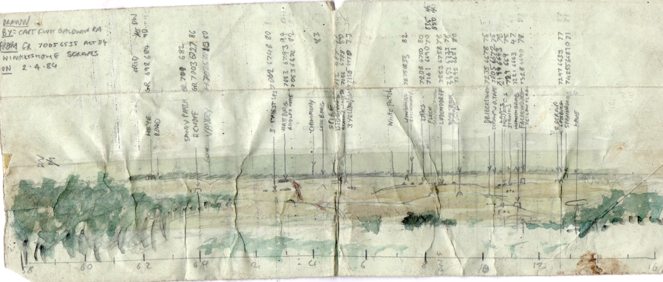
The answer may lie in making more use of panoramas, i.e. an annotated sketch of the landscape from the observer’s position. A couple of hundred years ago, when armies were starting to become professional, field sketching was a key skill for officers. The current issue of the Sandhurst Foundation’s “Wishstream “ magazine has an article about the staff of the Royal Military Academy in 1813. Until Ordnance survey maps became common, a sketch was the norm for pointing out the ground. The National Army Museum has a water-colour that is claimed to have been used on the battlefield of Waterloo.
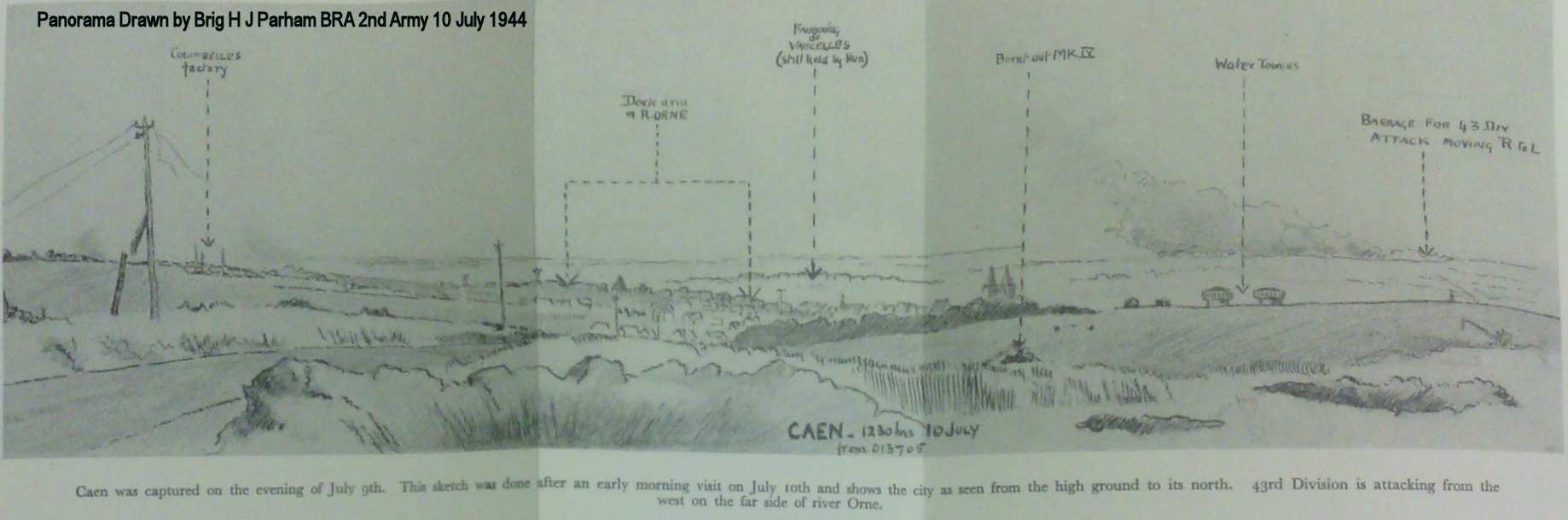
In the Second world war it was not unknown for senior officers to practice the art.
and even 1980s Cold War warriors were expected to draw an OP panorama.
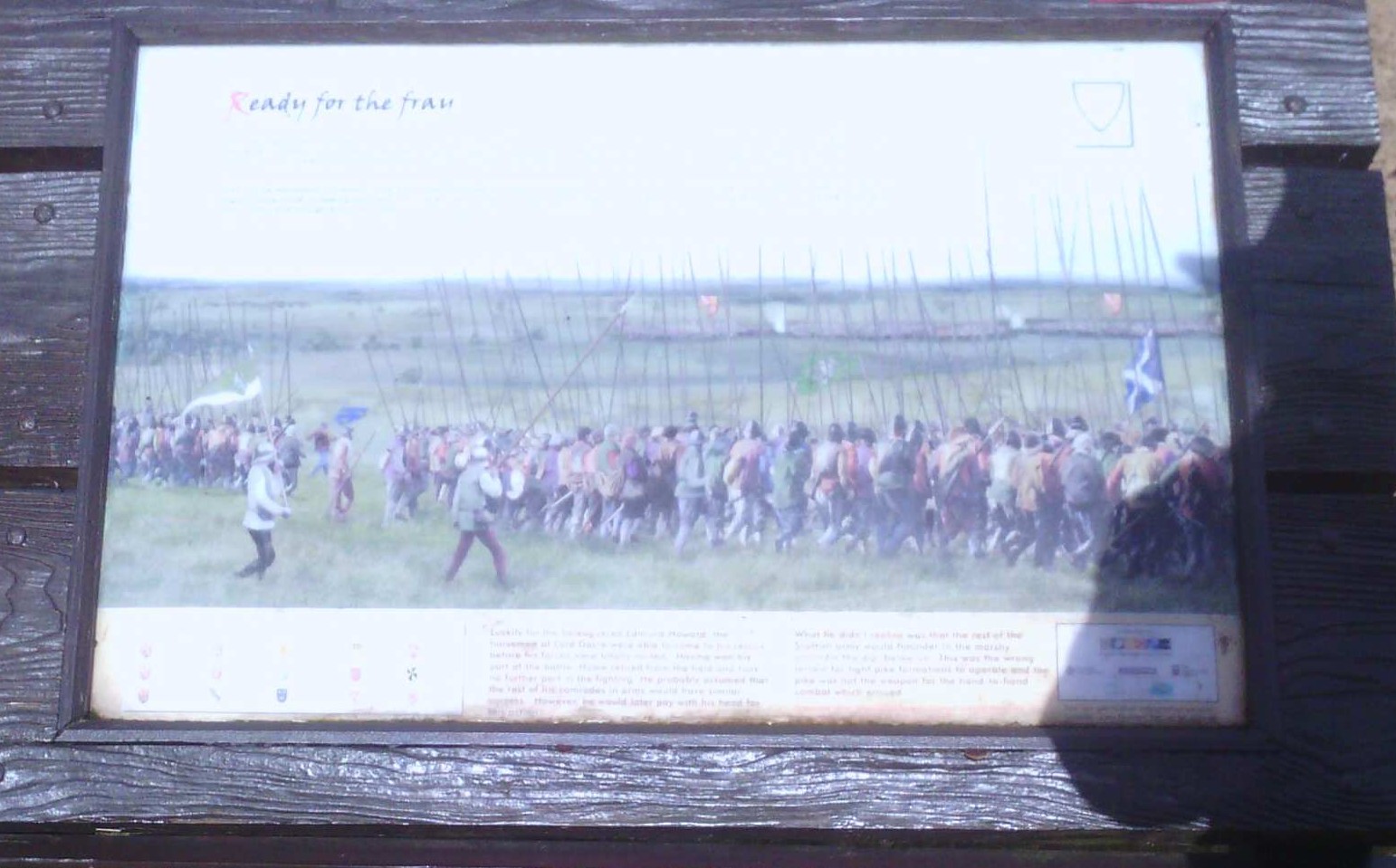
There is a secret behind Illustration 2 which means that the local guide, Clive Hallam Baker, shown addressing the Battlefields Trust Annual Conference in April 2013, can be happy that his audience know the ground as he describes the ground. The battlefield of Flodden has excellent interpretation boards showing panoramas illustrating the battle.
So perhaps battlefield guides should consider using panoramas as visual aids. On most occasion guides know where they will wish to stop and talk. Modern cameras, mobile phones and tablets can capture panoramas; and Google street view allows for a “Virtual recce”. The problem posed our experimental subjects would have disappeared if the audience had been given a panorama like this one, generated in 20 minutes.
If you would like to find out more about training for battlefield guides check the services I offer
![]()
